|
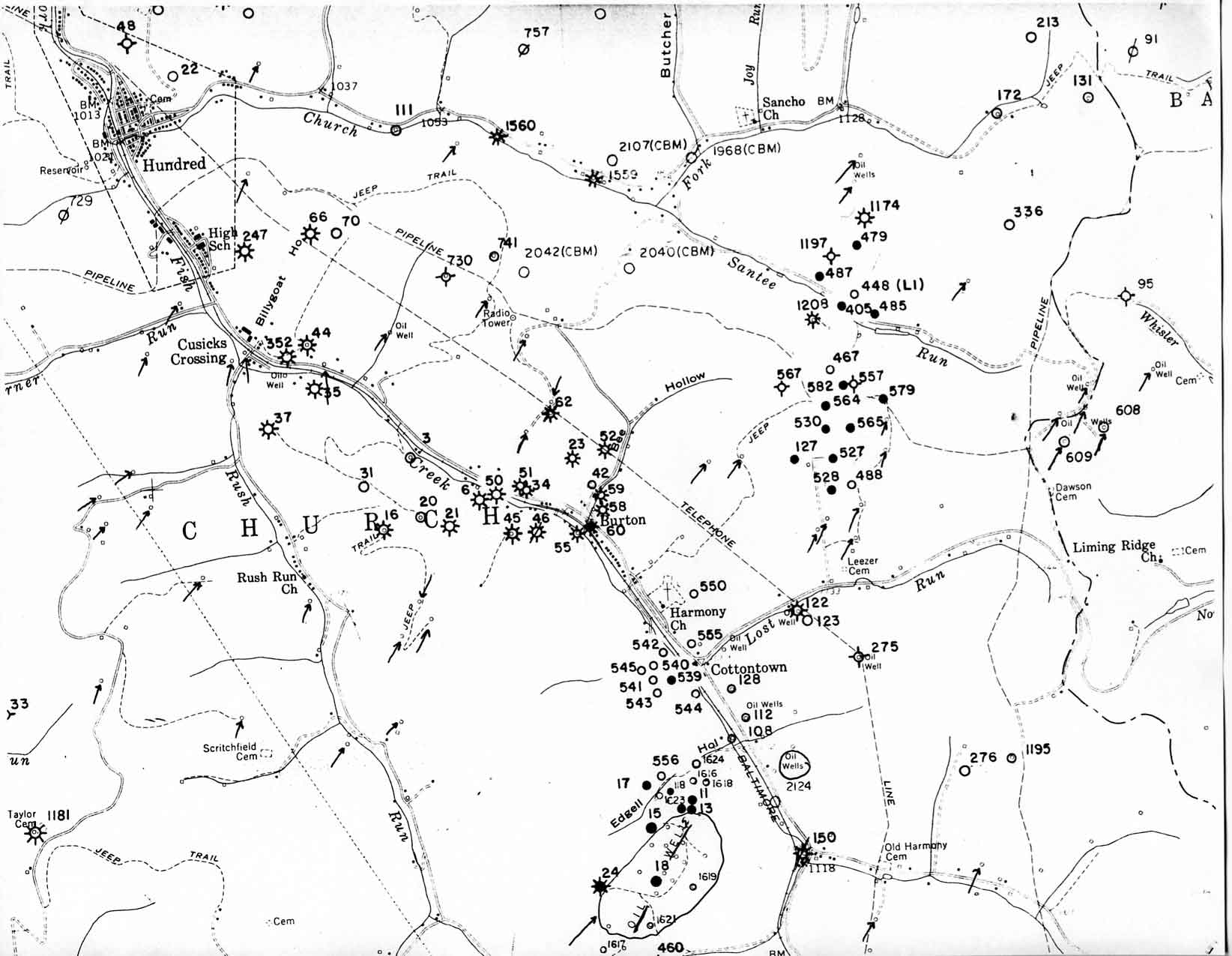 |
[Click for high resolution image] Note that the wells on the map with hand drawn arrows pointing to them are wells, mostly oil wells, that were drilled prior to 1929. They were drilled before the State began requiring drillers to keep records of where the wells were drilled, how deep, how cased etc. And most have not yet been plugged, or were plugged poorly, causing a huge potential for ground water pollution and worse. Their operator is probably long out of business. This problem is a whole additional problem plaguing oil and gas drilling. |
IV. Illustrated examples of the effects of drilling gas wells under Rule of Capture, and drilling wells using well spacing and royalty sharing.
When oil was first discovered in the late 1800's in the Eastern United States, people thought that it ran underground in rivers.
So if someone put a well down on a one acre tract, and it hit oil, people on neighboring tracts would drill wells too. And the owner of the original 1 acre tract might put down more wells on his one acre. The result is illustrated on this map showing topographic features and old and new oil and gas wells near the town of Hundred in Wetzel County. Look at all the wells!
| Go directly to intro or slide: 1 2 3 4 5 6 7 8 9 10 11 12 13 14 15 16 17 18 19 20 21 22 23 24 24a 25 26 27 28 29 30 31 32 33 |