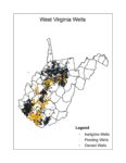
To easily find and view oil and gas well locations throughout West Virginia, go to EnviroMap Explorer on the West Virginia Department of Environmental Protection web site. (Note that these are all of the known gas well locations. Thousands of gas wells drilled before 1929 in some parts of West Virginia for which there are no known records.)
Then, in the box BELOW the map, checkmark the items set out under “map layers” under the “on” column. (You may have to scroll down using the box’s scroll bar in the right center of your page, not the scroll bar on the far right, in order to get to all of these):
-County Boundaries,
-Hillshade,
-Streams,
-Roads,
-Towns/Populated places, and
-Oil and Gas Wells
Click on the “Zoom In” button. (This is on the map toolbar and has 4 arrows pointing to the center) Then click on the part of the map you want enlarged. Or there is a way to click and drag a rectangle to select the desired area to enlarged.
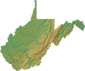
As you zoom in to about the county level, the well locations become visible, and the terrain becomes recognizable.
You can also check mark aerial photos or topographic maps of the desired area if you need to view them.
Then in another window, or at another time go here. You can download “Well Location Data” and “Production Data” and other data sets to find out more about the wells you have located. The best way to find wells on these downloads is by their “API” number. Every well has a unique API (American Petroleum Institute) well number which is like its Social Security Number.
To determine a well’s API number, the last 4 digits for each well are shown on the maps. The first two digits are always 47, indicating that the well is in West Virginia. The middle set of digits identifies the county where the well is drilled. Here are the well numbers for the counties of West Virginia. You do not need the district numbers shown.
Also, every well is supposed to have its API number shown on the well itself somewhere. So if you are interested in a well near your, get the number off of it and use it to find information about the well in these data bases. If there is no number on the well, call an oil and gas inspector and complain.


